

Safety, efficiency, and accuracy are paramount in the fast-paced mining world. From exploring new sites to maintaining existing operations, the demands are complex and challenging. Enter the world of 3D drone mapping, a groundbreaking technology reshaping the mining landscape.


An autonomous drone that can capture survey-grade maps transforms how mining survey teams approach their work. Whether it's the treacherous task of mapping inaccessible underground caverns or ensuring the structural integrity of an operational site, drones equipped with specialized technology like SLAM (Simultaneous Localization and Mapping) are providing once-unthinkable solutions.
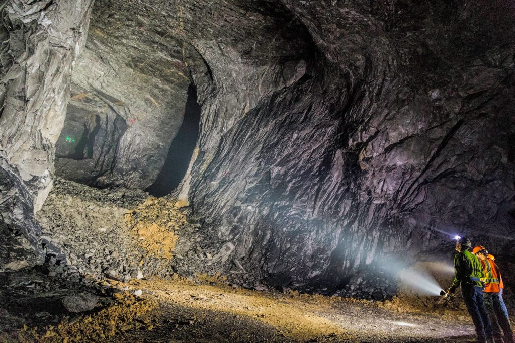
Hazardous working conditions and the time-consuming task of manual surveying and mapping have long presented issues for the mining industry. Now, drones offer an opportunity to enhance safety and efficiency significantly. Imagine mapping a dark, complex mine from a safe distance with a level of detail and accuracy that surpasses traditional methods. Or envision a world where real-time mapping allows for immediate response to potential risks, minimizing danger and maximizing productivity.
These scenarios are no longer the stuff of imagination; they are today's reality, thanks to innovations in 3D drone mapping. This technology is not just an advancement; it's a revolution, redefining the mining industry's future. Read on to discover how 3D drone mapping is taking the mining world by storm, offering unprecedented safety, speed, and accuracy possibilities. The future is here, and it's autonomous.

Imagine the ability to soar within geographies, capture their essence, and translate them into detailed maps or 3D models. That's what 3D drone mapping does.
Mapping caves and mine shafts is complex due to their inaccessible, dark, and often unpredictable nature. However, drones, especially those equipped with specialized technology, can assist in cave mapping and exploration in several ways. Also known as aerial surveying or aerial mapping, this technology leverages the power of drones, or unmanned aerial vehicles (UAVs), to achieve what was once considered unattainable.
Check out this short video to learn about what it’s like to plan and undertake a mission using drone mapping software.


Photogrammetry is the science of making measurements from photographs. In the case of drone mapping, it involves taking numerous overlapping photos from different viewpoints. Photogrammetry is a passive sensor technology that uses visible light to capture images. Software must then use these photos to create 3D models or maps.
Pros:
Cons:
SLAM is a computational method that allows a robot, such as an autonomous drone, to map an unknown environment while simultaneously tracking its position within it. It's particularly vital in navigating GPS-denied areas, like caves. To learn more and fly along to experience autonomous 3D mapping, click here.
SLAM can use various sensors to “see” its surroundings, including LiDAR, ultrasonic sensors, and cameras. LiDAR-based SLAM uses a LiDAR (Light Detection and Ranging) sensor to “see” its environment. Here’s how that process works:
Pros:
Cons:
Check out our blog post here for a deeper dive into LiDAR-based SLAM technology.

In an underground mine, SLAM is the go-to technology for several reasons:
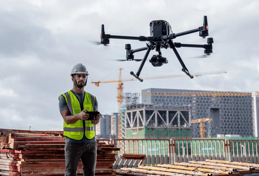
Keeping survey teams safe requires keeping them out of harm’s way. Remote technologies allow for data-gathering that doesn’t put human lives at risk. Even the most experienced, well-equipped surveyor increases their chances of injury the longer they stay underground. Tele-remote and semi-autonomous systems keep teams above ground and farther away from dangerous areas.
Sans technology, survey teams must map open, active stopes from their entrance, or berm, widely considered the most treacherous part of a mine. If a blast happened to break too far under the berm, it could create a potential collapse into the cavity. Virtual mapping prevents this type of accident. Autonomous drone capabilities allow survey teams to stand 30 or more meters away from that berm and fly into unknown cavities.
Lastly, since teams can capture these scans more quickly and often, 3d models of tunnels can be monitored over time for convergence monitoring to detect any changes. Shifts in the rock could indicate a potential collapse, and keeping abreast of these dangers saves lives.
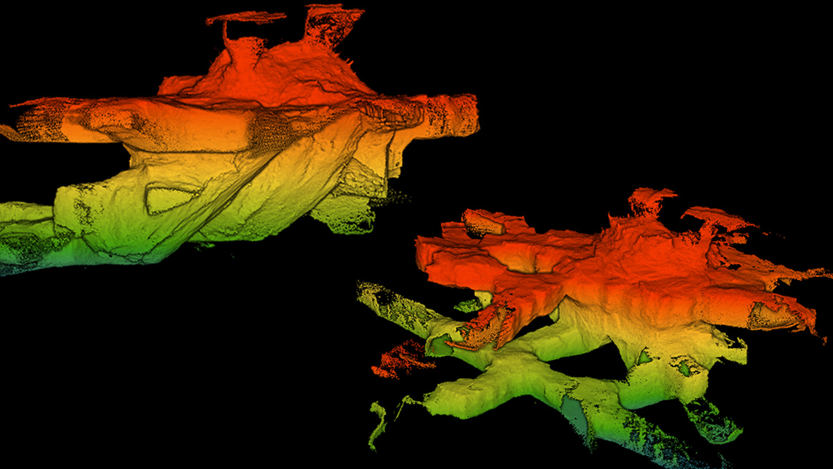
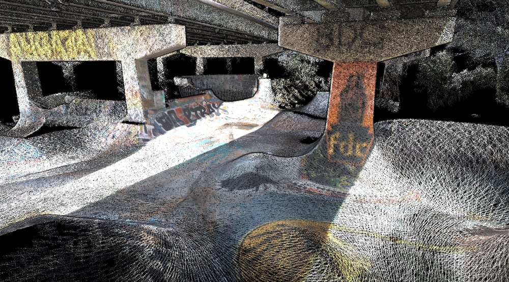
Autonomous drone mapping technology has been steadily advancing over the past decade and is often considered more accurate than other traditional mapping technologies. Critical to our customers, the ExynAero and ExynPak reliably capture survey-grade point clouds which can be quickly processed for volumetric analysis. Key reasons for this level of detail include
Underground caves present a challenging environment for mapping due to their dark, complex, and potentially hazardous nature. However, advances in drone technology are enabling more effective and faster mapping of these environments. Here's how:
In short, drones, particularly those equipped with advanced technologies and autonomous capabilities, can significantly increase the safety, accuracy, and speed of underground cave mapping. To learn even more about drone applications, click here.

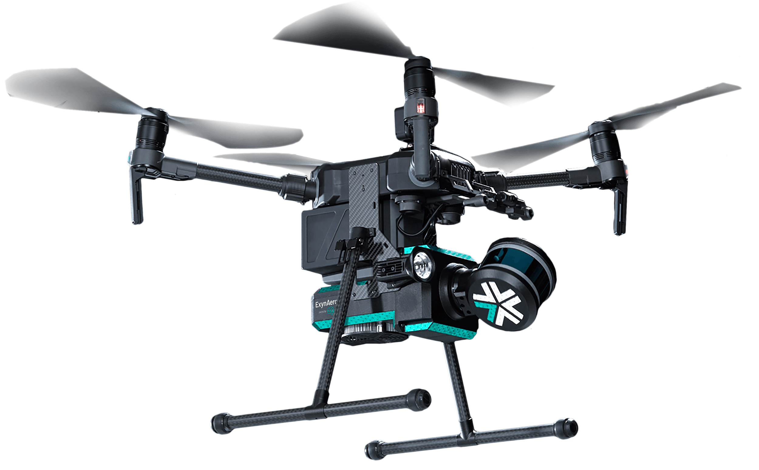
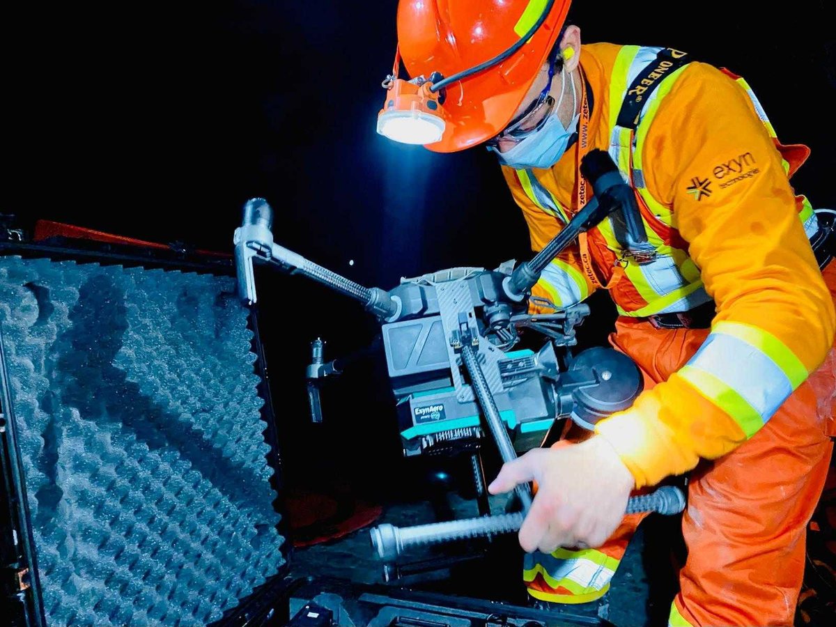
A miner and an autonomous robot may seem like unlikely friends, but ExynAI enables human workers to capture otherwise impossible data without the use of prior maps, GPS, or existing infrastructure.
The ExynAero EA6 is a fully-integrated, pilotless drone that easily navigates complex environments while gathering precise, 3D data. This remarkable drone uses the power of LiDAR-based SLAM to maximize human safety by optimizing efficient data collection.
Technology and AI come together to capture beyond-line-of-sight data without risking operator safety.
LiDAR-based SLAM isn't just a technical term; it's a powerful tool with broad applications, from industrial inspections to underground mining. Exyn is leading the charge in this technology, and we invite you to discover the difference. Whether you're in the mining industry or a researcher studying uncharted caves, 3D drone mapping can offer insights, efficiency, and safety like never before.
Book a demo today and witness the true power of autonomy in action.