

Welcome to the frontier of geospatial reality capture, where the convergence of advanced LiDAR-based SLAM (Simultaneous Localization and Mapping) technology and the ingenuity of products like Nexys are reshaping the way we map and understand our world.

This groundbreaking approach is not just a leap forward in surveying and data collection—it's a transformative journey into the future of digital twins and precise, real-world replications.
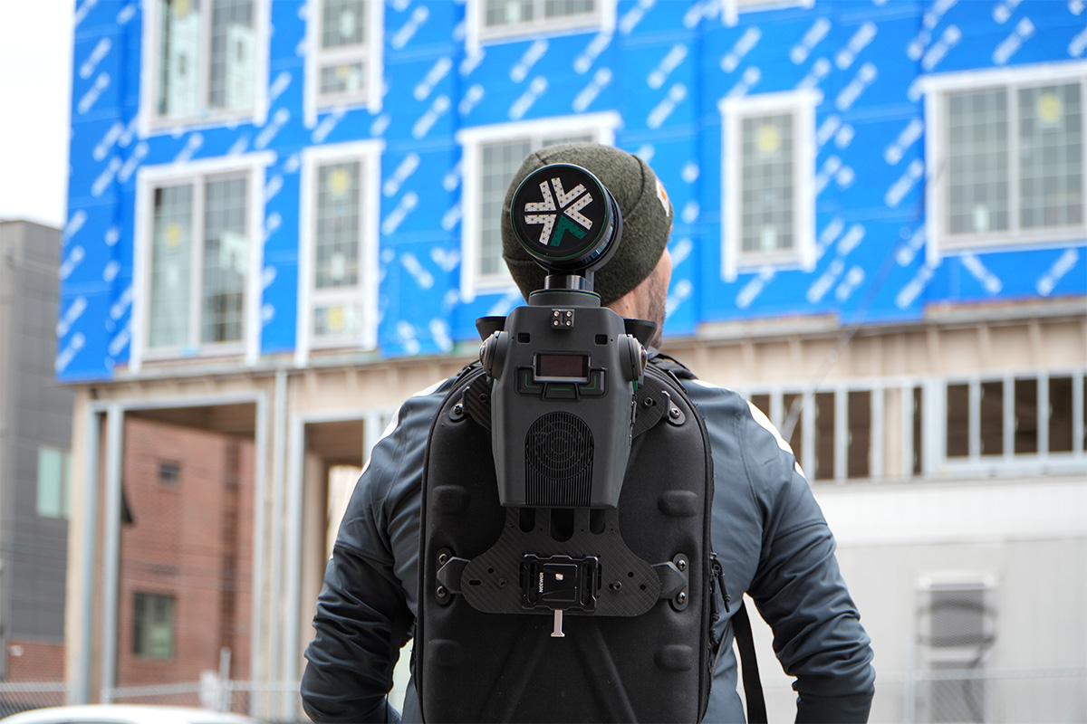
Reality capture is more than just a buzzword; it's a transformative technology that enables the creation of digital twins of real-world environments. This is particularly vital in areas where manual surveying is challenging or dangerous. With our advanced reality capture laser scanners, you can effortlessly map vast terrains or intricate spaces, ensuring survey-grade accuracy in your projects.

In the realm of geospatial reality capture, efficiency is key. Traditional methods often require extensive manpower and multiple trips to the field, resulting in increased time and costs. LiDAR-based SLAM robots, however, redefine this process, offering unparalleled efficiency and accuracy. By integrating mobile reality capture technologies, these robots capture detailed 3D data in a single pass, significantly reducing the need for repeated site visits.
Learn More

Simultaneous Localization And Mapping (SLAM) is a complex algorithm that allows a robot, such as an autonomous drone, to map an unknown environment while simultaneously tracking its position within it. It's particularly vital in navigating GPS-denied areas such as underground terrain.
SLAM can use various sensors to visualize its surroundings, including LiDAR, ultrasonic sensors, and cameras. LiDAR-based SLAM uses a LiDAR (Light Detection and Ranging) sensor to “see” its environment. Here’s how that process works:


In large-scale construction projects, the preparation and centralization of data are crucial. Architects will want to ensure their designs are being followed to keep work moving and clients happy, while contractors will want to track progress in real-time to better invoice for the project.
With reality capture products like Nexys, data is not only captured efficiently but also organized and processed for optimal usability. This centralized data approach allows for easier access and manipulation, aiding in better decision-making and project planning.

The advent of 3D reality capture products through LiDAR-based SLAM technology marks a significant advancement in the way we perceive and replicate our physical world. It's not just about mobile mapping systems; it's about creating a digital legacy that is as real and intricate as the environment itself.
And now that LiDAR-based SLAM 3d mapping systems can be deployed across an entire construction or inspection project, scans can be taken daily. This gives full transparency into progress tracking, risk management, and billing. Rapid, accurate digital twins captured through mobile mapping solutions have the power to democratize BIM modeling and tracking for the ever growing construction and surveying industries.

In summary, the integration of LiDAR-based SLAM technology into surveying workflows is revolutionizing the field of geospatial data. This technological collaboration offers unprecedented accuracy, efficiency, and safety in mapping and surveying, transforming the way industries view and interact with their physical spaces in capturing reality.
Are you ready to experience the future of geospatial reality capture? Contact us today to book a demo or learn more about how our reality capture solution can empower your next project. Step into a world where mobile mapping is no longer a task but an exploration into the very fabric of our reality.
