---
title: Drones for Stope Mining | Exyn Technologies
description: Exyn's aerial mapping drones for stope mining helps pave the way for a safer and more efficient mining operations.
image: https://www.exyn.com/hubfs/ExynAero-and-Kody.jpg
---
[ ](https://www.exyn.com/?hsLang=en)
[ Book a Demo ](https://cta-service-cms2.hubspot.com/web-interactives/public/v1/track/click?encryptedPayload=AVxigLLty2nph278fYyW6Go1HdK6TlhD9gGcAsDWA1S2JA1ovKfJP1kwVjquNca0EoM7594sP5AK0MA0lJIZnP3FP%2BV4Uf20jZQTq5BT2ZGlGPCrW4xyXDbJFnToPUp%2FgMdo%2Fkf8zr7MTk0NdzChKE5Okkbl42KJhLgw%2Bs8zsFQ%3D&portalId=8300473)
[ Book a Demo ](https://cta-service-cms2.hubspot.com/web-interactives/public/v1/track/click?encryptedPayload=AVxigLLty2nph278fYyW6Go1HdK6TlhD9gGcAsDWA1S2JA1ovKfJP1kwVjquNca0EoM7594sP5AK0MA0lJIZnP3FP%2BV4Uf20jZQTq5BT2ZGlGPCrW4xyXDbJFnToPUp%2FgMdo%2Fkf8zr7MTk0NdzChKE5Okkbl42KJhLgw%2Bs8zsFQ%3D&portalId=8300473)
  
# Drones for Stope Mining: How Mine Drone Improves Safety in Mining Operations
**

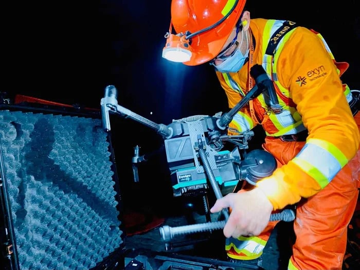
During the past two decades the mining industry has shifted from traditional underground cavity monitoring methods to more advanced robotic technologies in recent years. Among the most revolutionary advancements? The utilization of **autonomous drones for stope mining**.
But what exactly is stope mining, and how do drones play an integral role? Let's explore drone technology's incredible applications and benefits in this sector.
[Drones For Mining](https://www.exyn.com/drones-for-mining?hsLang=en)

## Understanding Stope Mining
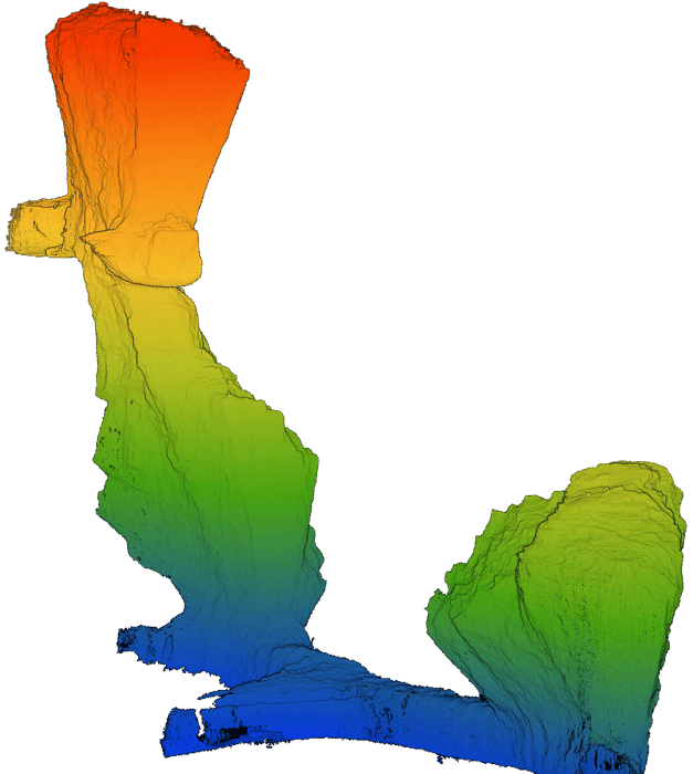
Stope mining, often called "stoping," is a method of extracting ore from underground mine by creating voids or open spaces called stopes. Traditional methods involved accessing the ore body through shafts or tunnels, removing it based on the ore body geometry, and ensuring the stability of the surrounding rock. This method required intensive manual labor, comprehensive safety checks, and elaborate surveying processes.
As the mining industry evolved, safer, more efficient, and data-centric mining practices were needed. Enter drones for mining. These autonomous flying machines, brimming with technology, have redefined the traditional stope mining methods.
   
## Harnessing the Power of Drones in Mining Operations
As mines delve deeper and span wider the challenges of ongoing, safe operations multiply requiring innovative solutions. From fine-tuning the intricacies of mine planning to ensuring environmental compliance, autonomous drones pave the way for a safer and more efficient mining operations.
Mine Planning
### Mine Planning
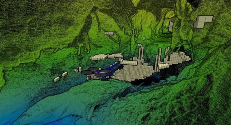
Traditional mine planning currently relies heavily on manual data collection using a stationary tripod with a laser scanner mounted to the end commonly referred to as a cavity monitoring system, or CMS. [Surveying and mapping](https://www.exyn.com/drone-surveying-and-mapping?hsLang=en) vast, inaccessible terrains have always been challenging for mining companies.
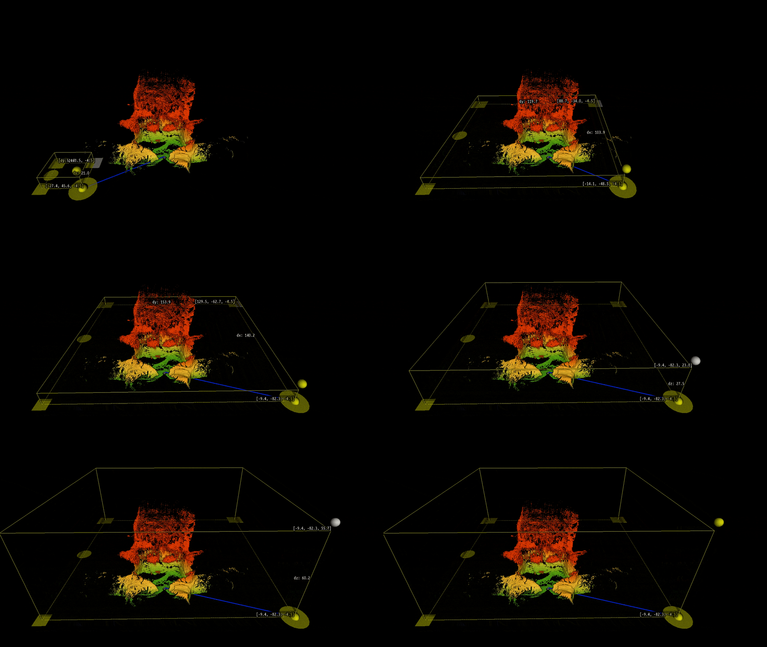
To map these massive, inaccessible cavities, drones are equipped with sophisticated LiDAR sensors so they can "see" even with no light. This data is then processed through a real-time Simultaneous Localization and Mapping (SLAM) algorithm so the robot can sense and avoid obstacles in confined spaces even without a pilot in the loop. This data is then further processed into a high fidelity [3D point cloud](https://www.exyn.com/news/power-of-processed-point-clouds?hsLang=en) for further analysis.
And all this can be done in a fraction of the time it used to take with a traditional CMS scanner. This can accelerate the mine planning process and provide a more comprehensive view of ongoing operations and available resources.
Agriculture
### Agriculture
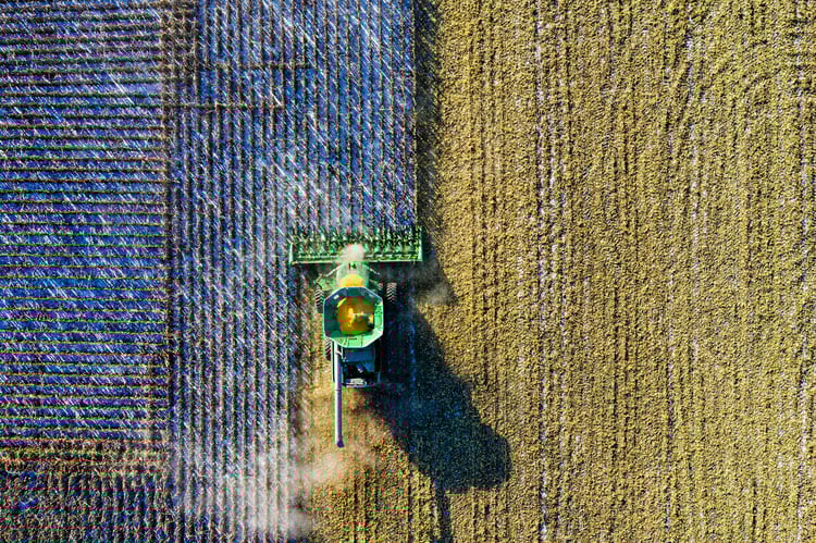
In the ever-evolving world of farming, precision and timely data are paramount. Drone services play a pivotal role in revolutionizing agricultural practices. With high-resolution aerial imagery, farmers can closely monitor their crops, tracking their growth and spotting potential issues before they escalate.
Additionally, drones offer insights into soil health and moisture levels, allowing farmers to make informed decisions about irrigation, fertilization, and pest control, optimizing resources and maximizing yield, ensuring sustainable and profitable farming.
Oil & Energy
### Oil & Energy
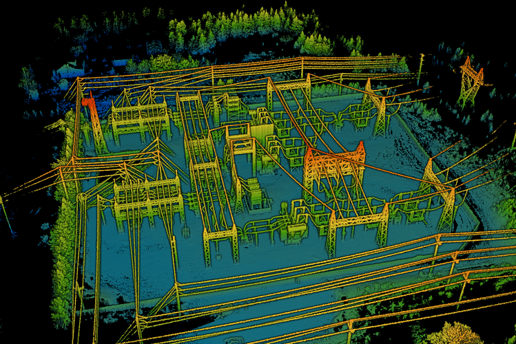
The oil and energy sectors are rife with complexities and potential hazards. Maintaining safety and operational efficiency is crucial in such an environment. Drone services are invaluable, offering periodic aerial inspections of oil rigs, pipelines, and energy installations.
These drones can easily access hard-to-reach areas, capturing detailed images and data vital for maintenance and safety checks. By identifying vulnerabilities or wear and tear early on, companies can prevent costly downtimes and ensure their facilities' continuous, safe operations.
Geospatial Mapping
### Geospatial Mapping
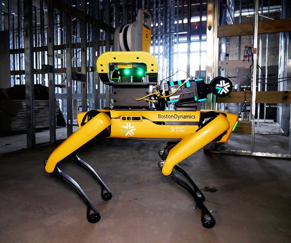
Exyn’s platform-agnostic AI performs autonomous aerial and ground-based robotic exploration. Designed for government and commercial sectors, our aerial survey mapping drones deliver safer and faster ISR. Whether preparing for a search and rescue operation, inspecting or monitoring critical infrastructure or pipelines, or gathering situational awareness of an unknown area, Exyn's multi-platform robotic autonomy delivers precise 3D maps in real time.
Exyn Technologies stands at the forefront of this revolution, leveraging advanced navigation mapping services to offer accurate and timely results for its partners.
### Mine Planning

Traditional mine planning currently relies heavily on manual data collection using a stationary tripod with a laser scanner mounted to the end commonly referred to as a cavity monitoring system, or CMS. [Surveying and mapping](https://www.exyn.com/drone-surveying-and-mapping?hsLang=en) vast, inaccessible terrains have always been challenging for mining companies.
To map these massive, inaccessible cavities, drones are equipped with sophisticated LiDAR sensors so they can "see" even with no light. This data is then processed through a real-time Simultaneous Localization and Mapping (SLAM) algorithm so the robot can sense and avoid obstacles in confined spaces even without a pilot in the loop. This data is then further processed into a high fidelity [3D point cloud](https://www.exyn.com/news/power-of-processed-point-clouds?hsLang=en) for further analysis.
And all this can be done in a fraction of the time it used to take with a traditional CMS scanner. This can accelerate the mine planning process and provide a more comprehensive view of ongoing operations and available resources.
### Agriculture

In the ever-evolving world of farming, precision and timely data are paramount. Drone services play a pivotal role in revolutionizing agricultural practices. With high-resolution aerial imagery, farmers can closely monitor their crops, tracking their growth and spotting potential issues before they escalate.
Additionally, drones offer insights into soil health and moisture levels, allowing farmers to make informed decisions about irrigation, fertilization, and pest control, optimizing resources and maximizing yield, ensuring sustainable and profitable farming.
### Oil & Energy

The oil and energy sectors are rife with complexities and potential hazards. Maintaining safety and operational efficiency is crucial in such an environment. Drone services are invaluable, offering periodic aerial inspections of oil rigs, pipelines, and energy installations.
These drones can easily access hard-to-reach areas, capturing detailed images and data vital for maintenance and safety checks. By identifying vulnerabilities or wear and tear early on, companies can prevent costly downtimes and ensure their facilities' continuous, safe operations.
### Geospatial Mapping

Exyn’s platform-agnostic AI performs autonomous aerial and ground-based robotic exploration. Designed for government and commercial sectors, our aerial survey mapping drones deliver safer and faster ISR. Whether preparing for a search and rescue operation, inspecting or monitoring critical infrastructure or pipelines, or gathering situational awareness of an unknown area, Exyn's multi-platform robotic autonomy delivers precise 3D maps in real time.
Exyn Technologies stands at the forefront of this revolution, leveraging advanced navigation mapping services to offer accurate and timely results for its partners.


## What Does a Drone Mapping Company Do?
Drone mapping companies are reshaping how we visualize and interact with the physical world by providing detailed and accurate depictions of landscapes, structures, and other terrains through advanced software and aerial tools capturing complex drone data.
Exyn Technologies is a leader among drone manufacturers – pioneering autonomous aerial robot systems for complex, GPS-denied environments.
[Read More About Drone Mapping Companies](https://www.exyn.com/drone-mapping-companies?hsLang=en)

Drone Mapping
## The Basics
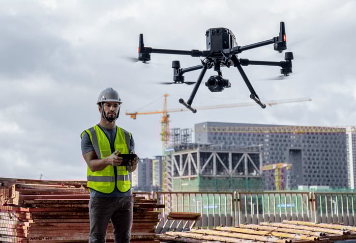
Once perceived as simple entertainment gadgets, drones equipped with autonomy have soared beyond this reputation to become pivotal assets, transforming numerous sectors. Their capabilities extend beyond just capturing compelling aerial images for real estate; drones play instrumental roles in constructing cutting-edge infrastructures, tracking the excavation of minerals deep from a mine site, and much more. As industries continuously seek to optimize operations, minimize inefficiencies, and bolster safety measures, drone technology emerges as the crucial catalyst propelling these advancements.
Whereas many of Earth’s regions once posed considerable challenges due to their inaccessible or unpredictable nature, using drones has drastically changed the game. Through aerial surveying, drones, particularly those equipped with advanced sensors and technology, can reach and map areas once deemed too challenging or risky. Whether it's navigating dense forests, mapping intricate urban landscapes, or studying varied topographical features, drones simplify and refine the process.

## Autonomy In Action
Equipped with Level 4A Autonomy Exyn's drones redefine the boundaries of aerial exploration. These state-of-the-art drones can freely navigate intricate spaces, dictating their flight paths at impressive speeds of 2 meters per second—double the rate of what was previously considered standard. This level of autonomy translates to capturing higher-quality data over broader areas. In optimal conditions, these robots can scan an astonishing 16 million cubic meters in just one flight, equivalent to surveying the volume of 9 football stadiums.
Their unparalleled autonomy sets Exyn's drones apart from older industry benchmarks. While earlier drone systems relied on waypoints and multiple flights to gather sufficient data, Exyn’s drones champion open-ended exploration without the need for human intervention during their flight (a monumental leap from Level 3 autonomy, where human drone pilots were essential, always on standby to take control if necessary).
Drone mapping powered by a Simultaneous Localization and Mapping (SLAM) algorithm involves using an aerial drone with high-resolution sensors like LiDAR to create high density 3D point clouds. The result? A point-for-point representation of the visual data or object of interest.
[Learn More About Autonomous Drone](https://www.exyn.com/news/exyn-drones-achieve-autonomy-level-4?hsLang=en)
   
## Benefits of Mapping With Drones
In today's fast-paced world, efficiency and accuracy in data collection are no longer luxuries but necessities. As industries and sectors strive to optimize operations, drone mapping emerges as a transformative tool that offers numerous advantages.
Safety
### Safety
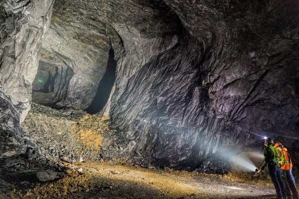
Some terrains and environments pose significant risks – the height of skyscrapers, the ruggedness of mountainous landscapes, a cavernous, uncharted underground, or the structural integrity of disaster-stricken areas. Drones eliminate the need for human intervention in such risky areas, ensuring safety by keeping teams at a safe distance while obtaining the necessary data.
Safety isn't just an added advantage; it's at the core of Exyn's philosophy. Exyn's drones, meticulously crafted for the unique challenges of mapping and surveying, boast cutting-edge autonomous navigation systems.
The [ExynAero](https://www.exyn.com/products/exyn-aero-aerial-mapping-drone?hsLang=en) is designed for remote launch capabilities, facilitating pilot-free flights even in areas without GPS or Beyond Visual Line of Sight (BVLOS) support, ensuring safe data capture in high-risk scenarios. Thanks to advanced engineering, these drones can intelligently identify and maneuver around obstacles, whether fixed infrastructure or mobile entities like vehicles or personnel. This blend of efficiency and safety makes Exyn's drones the go-to solution for data collection in ever-evolving and challenging environments.
[](https://cta-redirect.hubspot.com/cta/redirect/8300473/57396f92-3fbc-42c5-bbd2-fbf6fcbf28fe)
Speed
### Speed
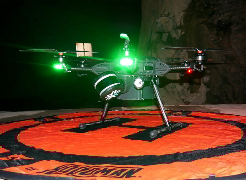
One of the most compelling advantages of drone mapping is the ability to cover vast land or structures quickly. Unlike manual methods, which often involve weeks or even months of work, drones can capture comprehensive data in hours or days, ensuring projects stay on schedule and stakeholders are promptly informed.
The onboard autonomy of Exyn drones means they don’t just collect data; they interpret it in real time, enabling them to navigate dense or cluttered spaces without any external piloting.
And it's not just about the speed during flight. Once these robots return, a drone survey team can [quickly process the captured data](https://www.exyn.com/products/exyn-aero-ea6#:~:text=Exyn%20sets%20the%20industry%20standard,less%20time%20than%20the%20flight.) on their tablet. Exyn sets the industry standard for high-speed map post-processing. Remarkably, this entire post-flight process takes less time than the flight duration.
[](https://cta-redirect.hubspot.com/cta/redirect/8300473/57396f92-3fbc-42c5-bbd2-fbf6fcbf28fe)
Accuracy
### Accuracy
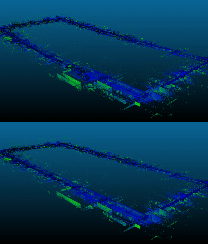
In mapping and surveying, precision is paramount. Exyn's robots set a benchmark in the commercial drone surveying and mapping industry, designed with a harmonious balance of safety and peak performance. Exyn's robots stand out in the retail drone surveying mapping market, built with safety and performance in mind. These devices can launch almost anywhere — beyond the visual line of sight or within intricate indoor areas.
Harnessing the power of [LiDAR-based SLAM](https://www.exyn.com/technology/lidar-mapping-technology?hsLang=en) (Simultaneous Localization and Mapping) technology, Exyn's robots are adept at adjusting to ever-changing settings to garner survey-grade data, even in the most challenging and inhospitable conditions. Unlike photogrammetry software, Exyn’s drones for mapping and surveying deliver robust data collection in low- or no-light conditions.
[](https://cta-redirect.hubspot.com/cta/redirect/8300473/57396f92-3fbc-42c5-bbd2-fbf6fcbf28fe)
Cost-Effectiveness
### Cost-Effectiveness
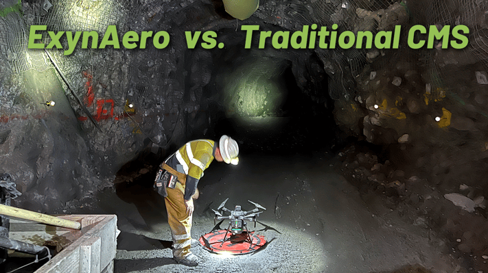
Financial prudence is critical in any project. [Drones significantly trim the expenses of large surveying teams, heavy machinery, and other equipment](https://www.exyn.com/exynaero-vs-cms?hsLang=en). Moreover, with drones, recurrent costs such as fuel for human-crewed aircraft or daily wages for large survey teams can be substantially minimized, leading to overall budget savings.
Drones have carved a niche in mapping and surveying, offering a blend of efficiency, safety, and accuracy. As technology continues to advance, the benefits of drone mapping will only expand, solidifying its role as an indispensable tool in modern data collection.
### Safety

Some terrains and environments pose significant risks – the height of skyscrapers, the ruggedness of mountainous landscapes, a cavernous, uncharted underground, or the structural integrity of disaster-stricken areas. Drones eliminate the need for human intervention in such risky areas, ensuring safety by keeping teams at a safe distance while obtaining the necessary data.
Safety isn't just an added advantage; it's at the core of Exyn's philosophy. Exyn's drones, meticulously crafted for the unique challenges of mapping and surveying, boast cutting-edge autonomous navigation systems.
The [ExynAero](https://www.exyn.com/products/exyn-aero-aerial-mapping-drone?hsLang=en) is designed for remote launch capabilities, facilitating pilot-free flights even in areas without GPS or Beyond Visual Line of Sight (BVLOS) support, ensuring safe data capture in high-risk scenarios. Thanks to advanced engineering, these drones can intelligently identify and maneuver around obstacles, whether fixed infrastructure or mobile entities like vehicles or personnel. This blend of efficiency and safety makes Exyn's drones the go-to solution for data collection in ever-evolving and challenging environments.
[](https://cta-redirect.hubspot.com/cta/redirect/8300473/57396f92-3fbc-42c5-bbd2-fbf6fcbf28fe)
### Speed

One of the most compelling advantages of drone mapping is the ability to cover vast land or structures quickly. Unlike manual methods, which often involve weeks or even months of work, drones can capture comprehensive data in hours or days, ensuring projects stay on schedule and stakeholders are promptly informed.
The onboard autonomy of Exyn drones means they don’t just collect data; they interpret it in real time, enabling them to navigate dense or cluttered spaces without any external piloting.
And it's not just about the speed during flight. Once these robots return, a drone survey team can [quickly process the captured data](https://www.exyn.com/products/exyn-aero-ea6#:~:text=Exyn%20sets%20the%20industry%20standard,less%20time%20than%20the%20flight.) on their tablet. Exyn sets the industry standard for high-speed map post-processing. Remarkably, this entire post-flight process takes less time than the flight duration.
[](https://cta-redirect.hubspot.com/cta/redirect/8300473/57396f92-3fbc-42c5-bbd2-fbf6fcbf28fe)
### Accuracy

In mapping and surveying, precision is paramount. Exyn's robots set a benchmark in the commercial drone surveying and mapping industry, designed with a harmonious balance of safety and peak performance. Exyn's robots stand out in the retail drone surveying mapping market, built with safety and performance in mind. These devices can launch almost anywhere — beyond the visual line of sight or within intricate indoor areas.
Harnessing the power of [LiDAR-based SLAM](https://www.exyn.com/technology/lidar-mapping-technology?hsLang=en) (Simultaneous Localization and Mapping) technology, Exyn's robots are adept at adjusting to ever-changing settings to garner survey-grade data, even in the most challenging and inhospitable conditions. Unlike photogrammetry software, Exyn’s drones for mapping and surveying deliver robust data collection in low- or no-light conditions.
[](https://cta-redirect.hubspot.com/cta/redirect/8300473/57396f92-3fbc-42c5-bbd2-fbf6fcbf28fe)
### Cost-Effectiveness

Financial prudence is critical in any project. [Drones significantly trim the expenses of large surveying teams, heavy machinery, and other equipment](https://www.exyn.com/exynaero-vs-cms?hsLang=en). Moreover, with drones, recurrent costs such as fuel for human-crewed aircraft or daily wages for large survey teams can be substantially minimized, leading to overall budget savings.
Drones have carved a niche in mapping and surveying, offering a blend of efficiency, safety, and accuracy. As technology continues to advance, the benefits of drone mapping will only expand, solidifying its role as an indispensable tool in modern data collection.
## Additional Benefits of Drone Surveying
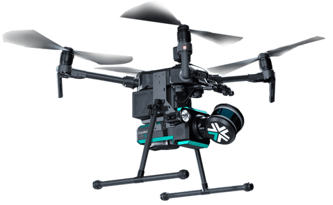
Surveying with drones isn’t just about technology – it’s about reshaping business solutions. Drones provide:
- **3D Modeling:** Drones can capture images from multiple angles, creating accurate 3D models and providing a significant advantage over traditional 2D mapping technologies.
- **Elimination of Human Error:** Traditional methods require measurements from multiple angles and repeated calculations where errors may occur. Technological computations eliminate the risks associated with human error.
- **Operational Efficiency:** Real-time data accelerates decision-making processes, reducing project timelines.
- **Repeat Surveying:** Drones can easily and quickly repeat the surveying process if necessary, ensuring complete, accurate, up-to-date maps of the survey site.
- **Environmental Responsibility:** Minimized land disruption preserves ecosystems and reduces carbon footprints.
- **Versatility:** The flexibility offered by drones combined with the accuracy of total stations means that surveyors can undertake a wide range of projects, from construction site monitoring to environmental study, drone land survey, archaeological site documentation, and more.
## Ready for Autonomous Mapping?
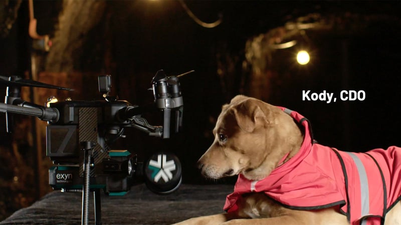
In this exploration, we've seen the multifaceted applications of drone mapping, from shaping the skylines of tomorrow in construction to redefining agricultural productivity and ensuring efficient harnessing of energy resources.
The drone mapping market is an evolving powerhouse central to the future of multiple industries. At the heart of this revolution, Exyn Technologies is pioneering innovative solutions that marry safety with precision.
Join us in this journey. Book a demo today to see firsthand how drone mapping is charting the course for a safer, more precise, and insightful future.
## Schedule Your Demo Today

Copyright © 2026 Exyn Technologies.
[(215) 999-0200](tel:+1%20215%20999-0200)
[Contact Us](https://www.exyn.com/about/contact?hsLang=en)