---
title: Drone Surveying and Mapping | Exyn Technologies
description: Deep dive into autonomous drone surveying and mapping which offers a glimpse into the future mapping vast terrains using a streamlined, automated marvel.
image: https://www.exyn.com/hubfs/ExynAero-and-Kody.jpg
---
[ ](https://www.exyn.com/?hsLang=en)
[ Book a Demo ](https://cta-service-cms2.hubspot.com/web-interactives/public/v1/track/click?encryptedPayload=AVxigLLty2nph278fYyW6Go1HdK6TlhD9gGcAsDWA1S2JA1ovKfJP1kwVjquNca0EoM7594sP5AK0MA0lJIZnP3FP%2BV4Uf20jZQTq5BT2ZGlGPCrW4xyXDbJFnToPUp%2FgMdo%2Fkf8zr7MTk0NdzChKE5Okkbl42KJhLgw%2Bs8zsFQ%3D&portalId=8300473)
[ Book a Demo ](https://cta-service-cms2.hubspot.com/web-interactives/public/v1/track/click?encryptedPayload=AVxigLLty2nph278fYyW6Go1HdK6TlhD9gGcAsDWA1S2JA1ovKfJP1kwVjquNca0EoM7594sP5AK0MA0lJIZnP3FP%2BV4Uf20jZQTq5BT2ZGlGPCrW4xyXDbJFnToPUp%2FgMdo%2Fkf8zr7MTk0NdzChKE5Okkbl42KJhLgw%2Bs8zsFQ%3D&portalId=8300473)
  
# Drone Surveying and Mapping
**

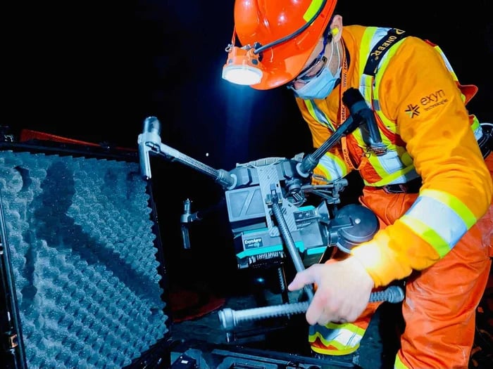
In the rapidly evolving world of technology, autonomous **drone surveying** and mapping are transformative forces reshaping numerous industries, including construction, mining, and geospatial mapping.
As businesses grapple with the demands of precision, speed, and efficiency of critical data capture, the introduction of drones powered by AI heralds a new age of opportunity. This deep dive into drone technology offers a glimpse into the future where mapping vast terrains is no longer a cumbersome task but a streamlined, automated marvel.
[Welcome to the revolution](https://www.exyn.com/technology/autonomous-robotics-software?hsLang=en)
   
## Mapping and Surveying Drone Capabilities
The rise of autonomous drone technology has paved the way for remarkable strides in surveying and mapping capabilities in dangerous hard-to-reach areas. Exyn's state-of-the-art drones push boundaries at the heart of this revolution, offering unmatched features that deliver tangible benefits.
Safety
### Safety
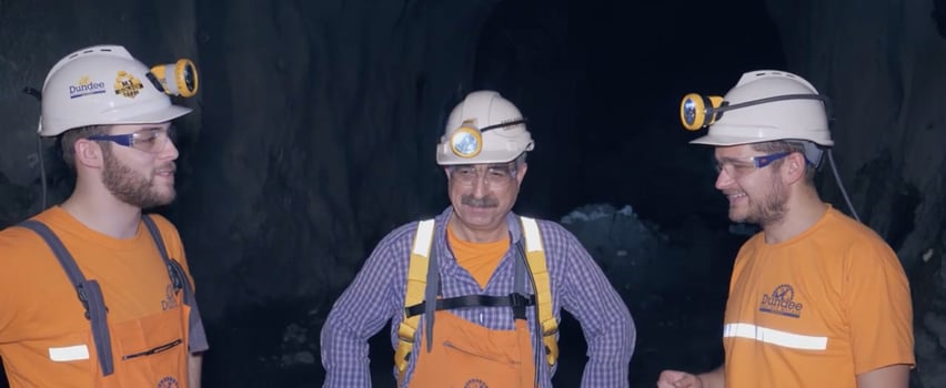
Safety isn't just a feature; it's a priority. Designed meticulously for deployment in potentially hazardous environments, Exyn’s drones for mapping and surveying offer fully autonomous navigation systems.
The [ExynAero](https://www.exyn.com/products/exyn-aero-aerial-mapping-drone?hsLang=en) enables workers to launch remotely and fly pilot-free without GPS or a WiFi connection to capture high-risk data safely. These robots are engineered to detect and navigate obstacles intelligently, whether stationary infrastructure or moving entities like humans, ensuring that these drones are efficient and safe and making the ideal choice for data capture in dynamic and unpredictable job sites.
Accuracy
### Accuracy
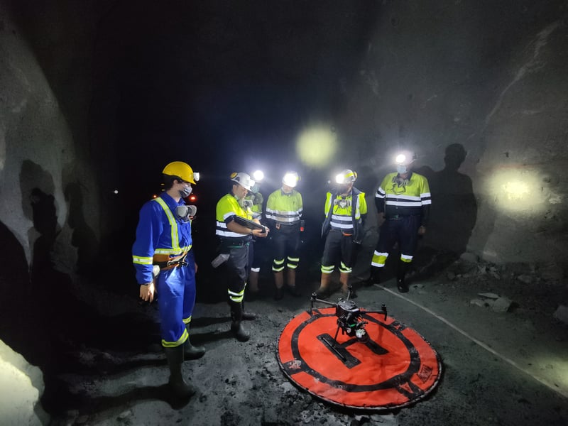
When it comes to mapping and surveying, accuracy is paramount. Exyn's robots stand out within the commercial drones surveying mapping market as they are built with safety and performance in mind. They can be deployed virtually anywhere — beyond the visual line of sight or within complex indoor spaces.
Equipped with advanced [LiDAR-based SLAM](https://www.exyn.com/technology/lidar-mapping-technology?hsLang=en) (Simultaneous Localization and Mapping) technology, these robots adapt to dynamic environments to capture survey-grade data and accurate measurements in harsh, unforgiving environments. Unlike photogrammetry software, Exyn’s drones for mapping and surveying deliver robust data collection in low- or no-light conditions.
Speed
### Speed
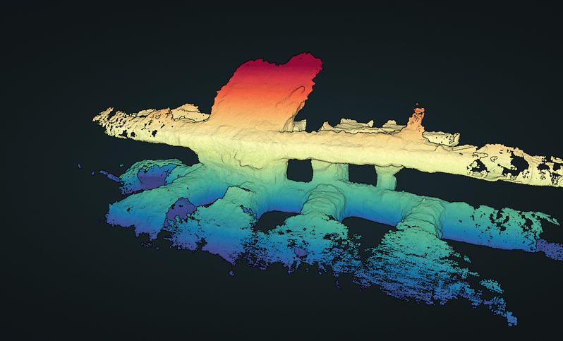
In today's fast-paced world, speed often differentiates between success and obsolescence. The onboard autonomy of our drones means they don’t just collect data; they interpret it in real-time, enabling them to navigate dense or cluttered spaces without any external piloting.
And it's not just about the speed during flight. Once these robots return, drone survey teams can [instantly process the captured data](https://www.exyn.com/products/exyn-aero-ea6#:~:text=Exyn%20sets%20the%20industry%20standard,less%20time%20than%20the%20flight.) on their tablets. Whether at the job site or in a remote control center, the post-processing speed ensures that the data is available for analysis in less time than the actual flight.
Our drones are not just about the hardware; they are about the perfect amalgamation of design, technology, and functionality. As we step into the future of drone surveying, these capabilities ensure accuracy, safety, and speed like never before.
### Safety

Safety isn't just a feature; it's a priority. Designed meticulously for deployment in potentially hazardous environments, Exyn’s drones for mapping and surveying offer fully autonomous navigation systems.
The [ExynAero](https://www.exyn.com/products/exyn-aero-aerial-mapping-drone?hsLang=en) enables workers to launch remotely and fly pilot-free without GPS or a WiFi connection to capture high-risk data safely. These robots are engineered to detect and navigate obstacles intelligently, whether stationary infrastructure or moving entities like humans, ensuring that these drones are efficient and safe and making the ideal choice for data capture in dynamic and unpredictable job sites.
### Accuracy

When it comes to mapping and surveying, accuracy is paramount. Exyn's robots stand out within the commercial drones surveying mapping market as they are built with safety and performance in mind. They can be deployed virtually anywhere — beyond the visual line of sight or within complex indoor spaces.
Equipped with advanced [LiDAR-based SLAM](https://www.exyn.com/technology/lidar-mapping-technology?hsLang=en) (Simultaneous Localization and Mapping) technology, these robots adapt to dynamic environments to capture survey-grade data and accurate measurements in harsh, unforgiving environments. Unlike photogrammetry software, Exyn’s drones for mapping and surveying deliver robust data collection in low- or no-light conditions.
### Speed

In today's fast-paced world, speed often differentiates between success and obsolescence. The onboard autonomy of our drones means they don’t just collect data; they interpret it in real-time, enabling them to navigate dense or cluttered spaces without any external piloting.
And it's not just about the speed during flight. Once these robots return, drone survey teams can [instantly process the captured data](https://www.exyn.com/products/exyn-aero-ea6#:~:text=Exyn%20sets%20the%20industry%20standard,less%20time%20than%20the%20flight.) on their tablets. Whether at the job site or in a remote control center, the post-processing speed ensures that the data is available for analysis in less time than the actual flight.
Our drones are not just about the hardware; they are about the perfect amalgamation of design, technology, and functionality. As we step into the future of drone surveying, these capabilities ensure accuracy, safety, and speed like never before.

## Drone Surveying and Mapping For Everyone
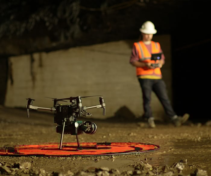
Autonomous drones have rapidly evolved from mere entertainment gadgets to indispensable tools that transform various sectors of the economy. They now hold the potential to revolutionize data collection in complex environments. From constructing state-of-the-art skyscrapers to capturing images for the real estate industry to digging deep into the earth's crust for minerals, drones are reshaping traditional methodologies and elevating them to new heights. As industries scramble to optimize, reduce inefficiencies, and enhance safety, autonomous drone technology is the game-changer we've all been waiting for.
   
## Drone mapping is making significant ripples across diverse sectors:
Construction
### Construction
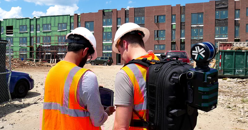
Commercial construction is an industry with much to gain from 3D geospatial mapping and aerial autonomy. A McKinsey study suggested that the American construction industry loses approximately $3 trillion annually to inefficiency and waste. This loss is mainly due to the complexity of planning and executing projects, the many constituents involved, and critical issues in collecting and transferring data.
Some construction and infrastructural development companies have launched autonomous drone systems or handheld 3D scanners to build maps of large-scale construction projects. They all focus on the building’s exterior and rely heavily on GPS or elaborate infrastructure such as RTK to create accurate exterior maps. However, the overwhelming majority of problems and inefficiencies of a construction project are inside the building, so existing solutions only address a minute part of the problem.
Construction build errors lead to expensive repairs or long-term damage if not detected early. By employing Exyn robots, construction professionals can routinely use UAVs to capture data in complex, dangerous environments. Our AI-powered drones capture survey-grade 3D maps of construction sites in progress, improving project management, reducing errors, and preventing waste.
[](https://cta-redirect.hubspot.com/cta/redirect/8300473/57396f92-3fbc-42c5-bbd2-fbf6fcbf28fe)
Mining
### Mining
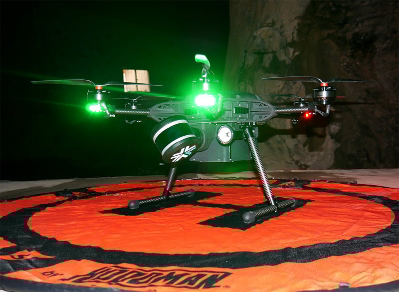
A miner and an autonomous robot may seem like improbable companions, but ExynAI enables human workers to capture otherwise unattainable data without using existing maps, GPS, or infrastructure.
The [ExynAero EA6](https://www.exyn.com/products/exyn-aero-ea6?hsLang=en) is a fully integrated, pilotless drone that easily navigates complex environments while gathering precise 3D data. This robot features a 4K camera and built-in lighting to deliver high-resolution video. The EA6 uses the power of LiDAR-based SLAM to maximize human safety by optimizing efficient data collection.
Technology and AI come together to capture beyond-line-of-sight data without risking operator safety. Exyn's pilot-free drones and portable ground systems deliver [precise 3D maps](https://www.exyn.com/drone-applications?hsLang=en), sensor data, and georeferenced models to the mining industry.
The ultimate goal in mining is to automate [underground operations](https://www.exyn.com/underground-drone-mapping?hsLang=en), thereby significantly decreasing the number of personnel underground, reducing costs, and dramatically improving safety. One of the critical enablers for this change is the availability of frequent, accurate, and rich maps of stope operations — which is the problem we uniquely address.
3D mapping technology offers distinct advantages within the mining industry, and [Exyn’s cutting-edge pilotless AI technology](https://www.exyn.com/?hsLang=en) delivers high-fidelity 3D data in the most challenging environments. The ExynAero launches at the press of a button and navigates pilot-free through the entire stope in a single cavity-monitoring flight.
Regulatory bodies in most areas require mining companies to carry out regular surveys, which, although reasonably accurate, are cumbersome, time-consuming, and produce limited data. Exyn's datasets are compelling because we can generate *1,000 times more points in a fraction of the time* while providing increased safety for surveyors.
[](https://cta-redirect.hubspot.com/cta/redirect/8300473/57396f92-3fbc-42c5-bbd2-fbf6fcbf28fe)
Geospatial Mapping
### Geospatial Mapping
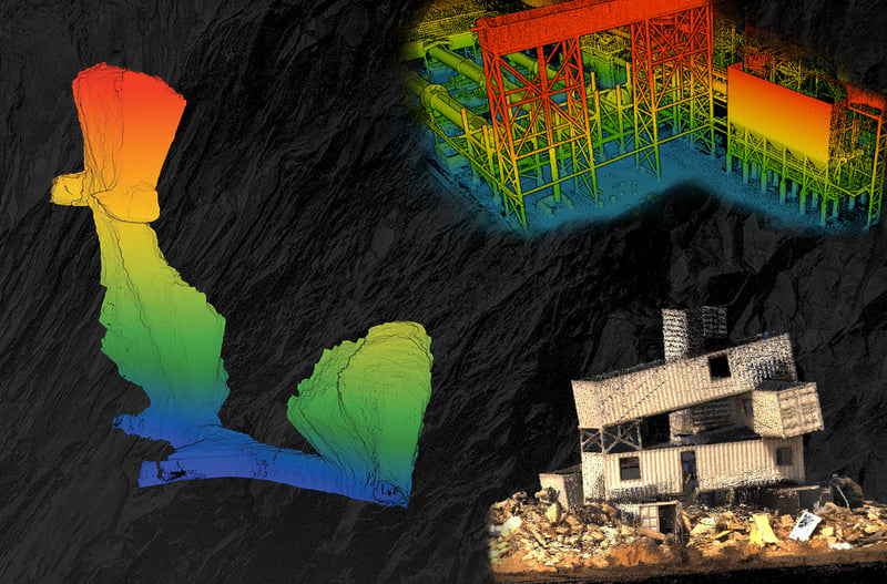
Exyn’s platform-agnostic AI is made for autonomous aerial and ground-based robotic exploration. Designed for government and commercial sectors, our aerial survey mapping drones deliver safer and faster ISR.
Whether preparing for a search and rescue operation, inspecting or monitoring critical infrastructure or pipelines, or gathering situational awareness of an unknown area, Exyn's multi-platform robotic autonomy delivers precise 3D maps in real time.
Exyn drones for surveying and mapping include the ExynScout – Ascent and the ExynScout – Asylon. The ExynScout on the Ascent Spirit platform has a unique co-axial design that can be disassembled to fit in a backpack. Powered by ExynAI, the small airframe can detect and avoid obstacles in real time while delivering precise 3D maps.
The ExynScout on Asylon is a cyber-hardened airframe for truly autonomous operation. Also equipped with ExynAI, ExynScout can explore and map secure, GPS-denied environments without a pilot in the loop while providing real-time point clouds overlaid with critical sensor data.
Versatile ExynAI can equip any robotic platform with autonomous AI capabilities, giving public sector leaders access to the complete insights and capabilities of robotic 3D mapping. Explore more about high-resolution aerial reconnaissance drones for surveying & mapping [here](https://www.exyn.com/industries/government-reconnaissance-drones?hsLang=en).
[](https://cta-redirect.hubspot.com/cta/redirect/8300473/57396f92-3fbc-42c5-bbd2-fbf6fcbf28fe)
### Construction

Commercial construction is an industry with much to gain from 3D geospatial mapping and aerial autonomy. A McKinsey study suggested that the American construction industry loses approximately $3 trillion annually to inefficiency and waste. This loss is mainly due to the complexity of planning and executing projects, the many constituents involved, and critical issues in collecting and transferring data.
Some construction and infrastructural development companies have launched autonomous drone systems or handheld 3D scanners to build maps of large-scale construction projects. They all focus on the building’s exterior and rely heavily on GPS or elaborate infrastructure such as RTK to create accurate exterior maps. However, the overwhelming majority of problems and inefficiencies of a construction project are inside the building, so existing solutions only address a minute part of the problem.
Construction build errors lead to expensive repairs or long-term damage if not detected early. By employing Exyn robots, construction professionals can routinely use UAVs to capture data in complex, dangerous environments. Our AI-powered drones capture survey-grade 3D maps of construction sites in progress, improving project management, reducing errors, and preventing waste.
[](https://cta-redirect.hubspot.com/cta/redirect/8300473/57396f92-3fbc-42c5-bbd2-fbf6fcbf28fe)
### Mining

A miner and an autonomous robot may seem like improbable companions, but ExynAI enables human workers to capture otherwise unattainable data without using existing maps, GPS, or infrastructure.
The [ExynAero EA6](https://www.exyn.com/products/exyn-aero-ea6?hsLang=en) is a fully integrated, pilotless drone that easily navigates complex environments while gathering precise 3D data. This robot features a 4K camera and built-in lighting to deliver high-resolution video. The EA6 uses the power of LiDAR-based SLAM to maximize human safety by optimizing efficient data collection.
Technology and AI come together to capture beyond-line-of-sight data without risking operator safety. Exyn's pilot-free drones and portable ground systems deliver [precise 3D maps](https://www.exyn.com/drone-applications?hsLang=en), sensor data, and georeferenced models to the mining industry.
The ultimate goal in mining is to automate [underground operations](https://www.exyn.com/underground-drone-mapping?hsLang=en), thereby significantly decreasing the number of personnel underground, reducing costs, and dramatically improving safety. One of the critical enablers for this change is the availability of frequent, accurate, and rich maps of stope operations — which is the problem we uniquely address.
3D mapping technology offers distinct advantages within the mining industry, and [Exyn’s cutting-edge pilotless AI technology](https://www.exyn.com/?hsLang=en) delivers high-fidelity 3D data in the most challenging environments. The ExynAero launches at the press of a button and navigates pilot-free through the entire stope in a single cavity-monitoring flight.
Regulatory bodies in most areas require mining companies to carry out regular surveys, which, although reasonably accurate, are cumbersome, time-consuming, and produce limited data. Exyn's datasets are compelling because we can generate *1,000 times more points in a fraction of the time* while providing increased safety for surveyors.
[](https://cta-redirect.hubspot.com/cta/redirect/8300473/57396f92-3fbc-42c5-bbd2-fbf6fcbf28fe)
### Geospatial Mapping

Exyn’s platform-agnostic AI is made for autonomous aerial and ground-based robotic exploration. Designed for government and commercial sectors, our aerial survey mapping drones deliver safer and faster ISR.
Whether preparing for a search and rescue operation, inspecting or monitoring critical infrastructure or pipelines, or gathering situational awareness of an unknown area, Exyn's multi-platform robotic autonomy delivers precise 3D maps in real time.
Exyn drones for surveying and mapping include the ExynScout – Ascent and the ExynScout – Asylon. The ExynScout on the Ascent Spirit platform has a unique co-axial design that can be disassembled to fit in a backpack. Powered by ExynAI, the small airframe can detect and avoid obstacles in real time while delivering precise 3D maps.
The ExynScout on Asylon is a cyber-hardened airframe for truly autonomous operation. Also equipped with ExynAI, ExynScout can explore and map secure, GPS-denied environments without a pilot in the loop while providing real-time point clouds overlaid with critical sensor data.
Versatile ExynAI can equip any robotic platform with autonomous AI capabilities, giving public sector leaders access to the complete insights and capabilities of robotic 3D mapping. Explore more about high-resolution aerial reconnaissance drones for surveying & mapping [here](https://www.exyn.com/industries/government-reconnaissance-drones?hsLang=en).
[](https://cta-redirect.hubspot.com/cta/redirect/8300473/57396f92-3fbc-42c5-bbd2-fbf6fcbf28fe)

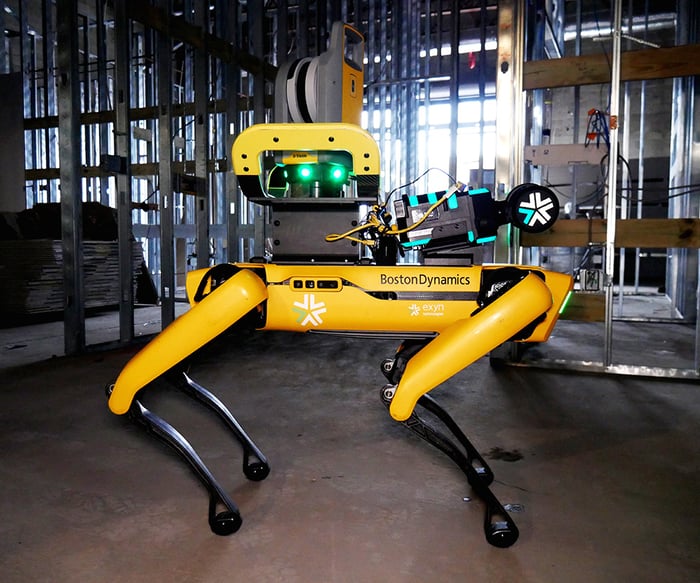
A powerful collaboration
## Drones in Construction
In 2022, Trimble (NASDAQ: TRMB) and Exyn Technologies collaborated to explore the use of autonomous construction surveying technology. The joint venture delved into the possibilities of self-navigating construction survey equipment, merging the capabilities of Boston Dynamic’s SpotⓇ robot with the ExynPak harnessing ExynAI, coupled with the Trimble® X7 total station. This combination demonstrated the possibilities for consistent and pinpoint accurate data collection in an active construction site, pivotal for production and quality assurance processes.
Powered by ExynAI, survey professionals simply set a 3D boundary for an assignment, and the unified robotic system adeptly manages self-navigation without relying on prior maps, GPS, or any wireless framework.
By incorporating the Trimble X7, rapid and precise 3D laser scans were conducted to record the state of the site. The gathered data was transferred to the Trimble Connect® platform, allowing collaboration among team members. This data transference facilitated in-depth analyses, like contrasting it with Building Information Models (BIM) and previous scans, to ensure quality monitoring and progress tracking. The outcome? A highly detailed and precise map rendered with reduced human involvement and potential risk.
[Learn more about autonomous robots in construction](https://www.exyn.com/industries/construction-inspection-drones?hsLang=en)
## The Intersection of Traditional and Modern Techniques
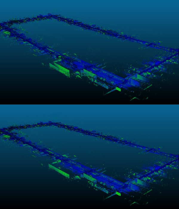
The combination of using ground control points (GCPs) established by total stations and aerial images from drones exemplifies how the convergence of traditional and modern surveying techniques can yield more accurate and efficient results. This integration has revolutionized the field of geospatial data acquisition in several ways:
1. **Enhanced Precision:** Drones can quickly cover large areas, capturing high-resolution images. However, there could be slight discrepancies without the accuracy provided by GCPs determined by total stations. By merging these two techniques, surveyors can ensure the breadth of coverage and absolute accuracy.
2. **Time Efficiency:** Traditional methods used for land surveys, especially over rugged or vast terrains, can be time-consuming. Drones can drastically reduce the time needed for land survey data collection. With pre-established GCPs, drone surveys are fast and precisely calibrated to provide accurate data.
3. **Cost Efficiency:** While there is an initial investment in drone surveying services and total stations, the savings in person-hours, reduced need for additional equipment (like safety gear for challenging terrains), and the speed of data collection can lead to significant cost savings in the long run.
4. **Versatility:** The flexibility offered by drones combined with the accuracy of total stations means that surveyors can undertake a wide range of projects, from construction site monitoring to environmental study, drone land survey, archaeological site documentation, and more.
The world of surveying has witnessed a significant transformation with the advent of drone technology. But rather than replacing traditional methods, drones have enhanced them. The symbiotic relationship between time-tested techniques, like the use of total stations and GCPs, with the cutting-edge capabilities of drones ensures that the geospatial industry is well-equipped to tackle the diverse challenges of the 21st century. As technology within the industry evolves, seeing how these tools and methods further intertwine and innovate will be exciting.
   
## Our Drone Surveying Process
### Exyn Technologies has fine-tuned its surveying processes to perfection, ensuring that every flight seamlessly merges innovation with functionality from launch to completion.
[
Effortless Launch
We've tailored our design to prioritize operators, not pilots. With ExynAI, you can direct your drone to explore a specific volume, target, or waypoint. The beauty of it all? The drone surveyor’s entire flight is commanded straight from a tablet, eliminating the need for bulky or complicated controllers. It's as simple as launching, pilot-free, at the mere press of a button. ](https://www.exyn.com/?hsLang=en) [
Fly in GPS-Denied Environments
Our autonomous drones break through conventional limitations. The ExynAero, now with Autonomy Level 4, navigates complex environments without a pilot while gathering precise 3D data. ](https://www.exyn.com/?hsLang=en) [
Lighting-Fast Data Processing
Exyn sets the industry standard for high-speed map post-processing. When ExynAero concludes its mission and returns, survey teams can process the drone data from their tablets. Remarkably, this entire post-flight process takes less time than the flight duration. ](https://www.exyn.com/?hsLang=en) [
Adaptable & Agile: Built for Every Terrain
Exyn’s surveying technology combines portability with durability. Designed to be hand-carried, our equipment is lightweight, ensuring ease of transportation. However, its robust build enables it to be mounted on land-based vehicles, facilitating ground-level or subterranean explorations. ](https://www.exyn.com/?hsLang=en) [
Delivering Real-Time, Survey-Grade Data
Our data capture technology is nothing short of advanced and impressive. It ensures that teams receive instantaneous results that inform and empower strategic decision-making processes. ](https://www.exyn.com/?hsLang=en)
## Autonomous Surveying & Mapping with ExynAero
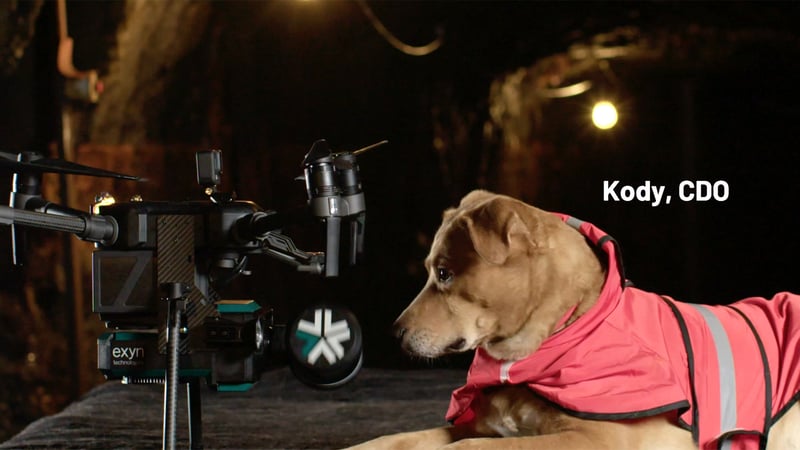
Remember that feeling when you first heard about drones mapping entire terrains? The sheer thrill of a future where complex processes become straightforward tasks? Well, that future is here, and Exyn is at the forefront of it.
If you've been nodding along, thinking about how this could reshape your projects or business, let's take this conversation from the screen to real life. Schedule a demo with us. Dive hands-on into the revolution. Experience the magic of Exyn's drone technology firsthand.
## Schedule Your Demo Today

Copyright © 2026 Exyn Technologies.
[(215) 999-0200](tel:+1%20215%20999-0200)
[Contact Us](https://www.exyn.com/about/contact?hsLang=en)